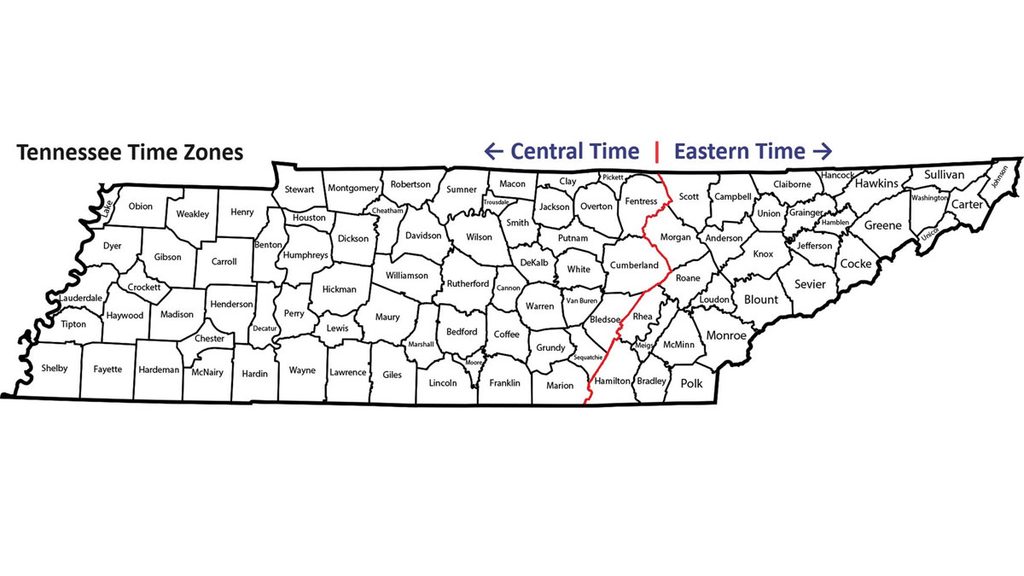
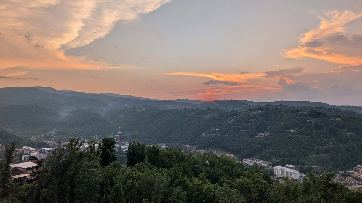

Crossville is in East Tennessee, but its clocks run on Central Time.
If you’ve been using “East Tennessee” and “Eastern Time” interchangeably, that detail can make the map confusing. Regional boundaries, landscapes, and time zones describe different things, even when they sometimes line up.
East, Middle, and West Tennessee are the state’s three Grand Divisions. Understanding them helps explain the regional names you hear, the differences you notice traveling across the state, and the three stars on Tennessee’s flag.
What Are Tennessee’s Three Grand Divisions?
Tennessee’s Grand Divisions are officially defined groups of counties. The state’s county lists place 33 counties in East Tennessee, 41 in Middle Tennessee, and 21 in West Tennessee. Together, they account for all 95.
Those numbers don’t divide Tennessee into three equal pieces. They tell you which counties belong to each region. For an exact boundary, county assignments matter more than where the mountains seem to end.
Regional identities developed as communities grew around different landscapes, river systems, and economic connections. These were already inhabited Indigenous homelands before European settlers established communities in the northeastern valleys and around the Cumberland River. Later settlement expanded into Chickasaw lands in the west.
Formal legal recognition followed in the nineteenth century. An 1835–1836 law connected the divisions to the state’s court system. The county arrangement continued to develop afterward; today’s map did not appear all at once.
You can see the three-region idea on Tennessee’s flag. Its three white stars represent the Grand Divisions. The white band surrounding the blue circle symbolizes their unity.
The divisions also retain a role beyond regional names and flag symbolism. Tennessee has five Supreme Court judges, and its constitution allows no more than two to reside in the same Grand Division. That requirement ensures the court’s membership comes from all three regions.
East Tennessee: Beyond the Smokies
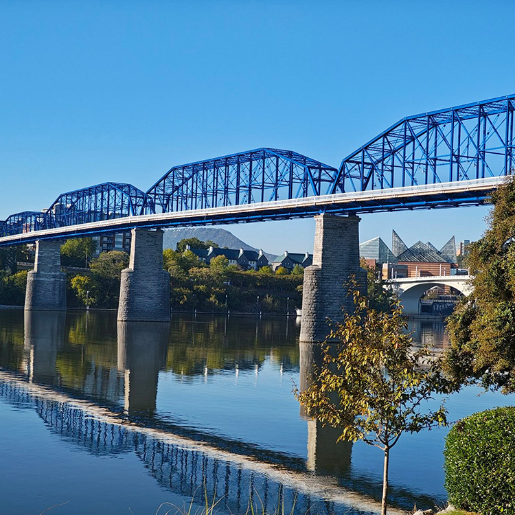
The Smokies may be the first landscape you picture when someone mentions East Tennessee. They occupy only part of a region stretching from Bristol, Kingsport, and Johnson City through Knoxville and southwest toward Chattanooga and Marion County.
Along the way are high mountains, long valleys, farms, reservoirs, industrial cities, and plateau towns.
Three broad landscapes help explain the variety: the Blue Ridge mountains along North Carolina, the Valley and Ridge country farther west, and portions of the Cumberland Plateau and Cumberland Mountains.
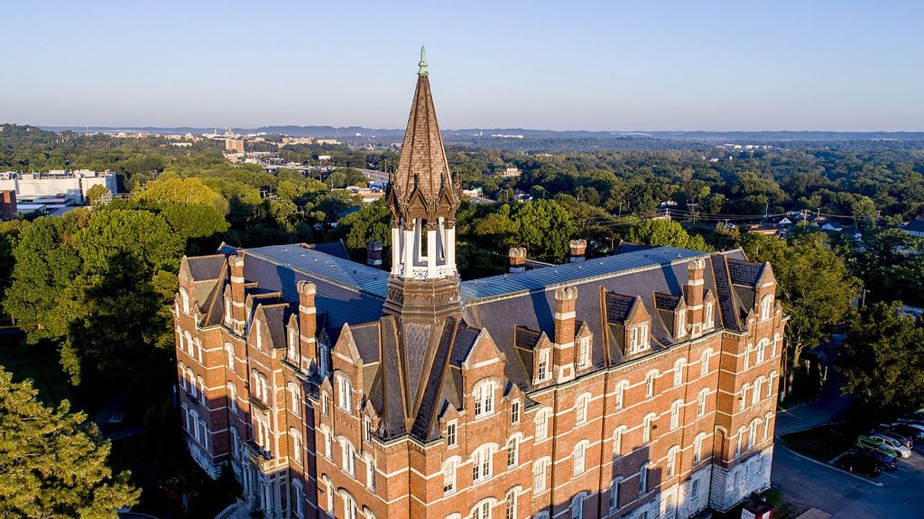
Crossville sits on the plateau. Knoxville lies in the Valley and Ridge landscape. Neither has the same setting as the high elevations of Great Smoky Mountains National Park.
Elevation makes a practical difference, too. According to National Park Service weather guidance, temperatures in the Smokies can differ by roughly 10–20 degrees Fahrenheit between the mountain base and summit. A comfortable afternoon in a valley does not tell you what conditions will be like higher up.
If the park is part of your trip, our guide to Smoky Mountains crowd levels by month can help you choose when to go.
The region’s rivers and valleys also help explain its history. Tennessee’s name is connected to Tanasi, a Cherokee town in present-day Monroe County. Southeastern Tennessee later became a major detention and departure area during the forced removal of Cherokee people in 1838–1839. At Blythe Ferry, that history is tied to a specific Tennessee River crossing.
Later developments brought different kinds of work and communities. Oak Ridge’s federal scientific role began during the Manhattan Project; Oak Ridge National Laboratory started in 1943 as Clinton Laboratories. Chattanooga developed a substantial manufacturing economy, while Knoxville’s university and service businesses became important parts of city life.
East Tennessee also offers an important chapter in country music history. The 1927 Bristol Sessions helped launch the commercial careers of the Carter Family and Jimmie Rodgers.
Middle Tennessee: The Basin, the Rim, and Beyond Nashville
Nashville helps orient you on a Middle Tennessee map. Then look outward toward Clarksville, Murfreesboro, Columbia, and Cookeville, along with smaller communities such as Bell Buckle and Dunlap.
The division’s 41 counties reach from the Tennessee River boundary area in the west into plateau country in the east. That includes far more countryside, forest, and rugged terrain than a Nashville visit alone would suggest.
Much of the landscape makes more sense once you understand the Nashville Basin and the surrounding Highland Rim. The basin is a geological feature, distinct from the city’s metropolitan area. Around it, the land rises into uplands, forested slopes, and river valleys. Farther east are plateau landscapes, gorges, and waterfalls.
Near Manchester, Old Stone Fort offers a starting point for understanding the region’s deeper history. Despite its name, it is an Indigenous enclosure from the Middle Woodland period, approximately 2,000 years old. European settlers did not build it as a military fort.
The Cumberland Compact of 1780 documents a much later chapter: settler government around the Cumberland River. River transport helped connect growing communities and move agricultural and industrial goods. On the western Highland Rim, iron production created an industrial landscape beyond the capital, including operations that depended on enslaved labor.
Today, Nashville’s healthcare and entertainment businesses sit within a region that also includes automotive manufacturing in Smyrna and Spring Hill, along with varied farming and nursery production.
On Nashville’s Music Row, Historic RCA Studio B connects that recording history to a specific place. Country and pop artists recorded there, helping establish Nashville as a commercial music center.
Toward the division’s eastern edge, wooded ridges and plateau towns replace the familiar image of the Nashville Basin.
You don’t leave Middle Tennessee simply because the scenery becomes rugged.
West Tennessee: Two Rivers and the Country Between Them
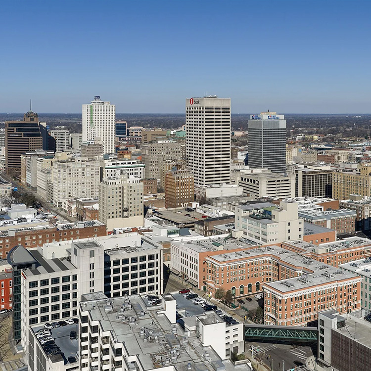
West Tennessee lies broadly between the Mississippi River and the western, north-flowing reach of the Tennessee River. Those waterways help explain both its landscape and its development.
Memphis and Jackson help orient you. Union City, Paris, Brownsville, and Savannah show the division’s reach into northwestern communities, farming areas, and the Tennessee River valley.
Much of West Tennessee belongs to the Coastal Plain, but it is not uniformly flat. Mississippi River floodplains sit below bluffs. Interior farmland gives way to rolling uplands, while hills rise near the Tennessee River.
Reelfoot Lake gives the northwestern corner a distinctive wetland landscape. Its formation is associated with land subsidence during the 1811–1812 New Madrid earthquake sequence. That history is more complicated than the familiar story that the Mississippi simply “ran backward” and created the lake.
The rivers connected people long before Tennessee’s modern boundaries existed. Pinson Mounds near Jackson was part of far-reaching Indigenous ceremonial and exchange networks. Chucalissa, in Memphis, provides another place to understand that history within a modern city.
The 1818 Chickasaw cession opened a major period of settler expansion into western Tennessee. Cotton production and enslaved labor profoundly shaped the economy that followed.
Cotton remains part of the story, but contemporary farming also includes corn, soybeans, wheat, and other crops. Today’s fields reflect a more varied agricultural economy than the old cotton-country shorthand suggests.
Memphis’s freight and logistics businesses continue the region’s long connection to moving goods. Its transport network reaches into Arkansas and Mississippi, extending beyond both Tennessee’s border and the Grand Division.
The city’s recording history reaches across genres, too. Stax offers a specific connection to soul music, while Memphis’s wider musical history includes blues, gospel, country, and rock.
Where the Boundaries Get Confusing
Natural features help explain Tennessee’s regional map, but county assignments settle the exact boundaries.
The Tennessee River is a good example. It begins at the meeting of the Holston and French Broad rivers at Knoxville, travels southwest through East Tennessee, loops through northern Alabama, and returns north through western Tennessee toward Kentucky.
Only its western reach provides the broad Middle–West dividing line. Living beside the Tennessee River does not automatically place you in West Tennessee.
Then there is Hardin County. The river runs through it, but the entire county belongs to West Tennessee. Crossing from one riverbank to the other within Hardin does not change your Grand Division.
The East–Middle boundary follows county lines through the broader Cumberland Plateau area. Cumberland, Bledsoe, and Marion counties are East Tennessee; Putnam, Van Buren, Grundy, and Sequatchie are Middle Tennessee.
Sequatchie County is therefore Middle Tennessee, despite its valley continuing toward Marion County in East Tennessee. The scenery doesn’t change just because the county line does.
The Fall Creek Falls landscape makes the point another way. Its natural area extends into Bledsoe and Van Buren counties, crossing the East–Middle boundary.
Time zones follow their own federal boundary. All of Middle and West Tennessee use Central Time. Most of East Tennessee uses Eastern Time, but Cumberland, Bledsoe, and Marion counties use Central.
Two examples: traveling from Cookeville to Crossville changes your Grand Division without changing your clock. Traveling from Crossville to Knoxville changes your clock while keeping you in East Tennessee.
Other regional maps serve different purposes. Tourism labels such as Upper Cumberland describe visitor areas. Metropolitan boundaries describe connections around cities. State agencies may have separate service territories; TDOT, for example, uses four regions.
When the distinction matters, check which kind of region the map actually shows.
A Quick Comparison
| Grand Division | Counties | Geographic anchors | Defining landscapes | Useful distinction |
|---|---|---|---|---|
| East Tennessee | 33 | Knoxville, Chattanooga, the Tri-Cities, Crossville | Blue Ridge mountains, valleys and ridges, portions of the Cumberland Plateau | Includes both Central and Eastern Time; extends well beyond the Smokies |
| Middle Tennessee | 41 | Nashville, Clarksville, Murfreesboro, Columbia, Cookeville | Nashville Basin, Highland Rim, plateau areas and gorges | Includes countryside, smaller cities, and rugged terrain beyond Nashville |
| West Tennessee | 21 | Memphis, Jackson, Union City, Paris, Savannah | Mississippi floodplains and bluffs, wetlands, rolling uplands, Tennessee River valley | Includes all of Hardin County, on both sides of the Tennessee River |
For ideas on where to explore, start with these Tennessee places recommended by locals.
For an exact regional assignment, start with the county. For a trip, go one step further: check the destination’s terrain, local forecast, and time zone. The Grand Division gives you context; those details help you plan the day.