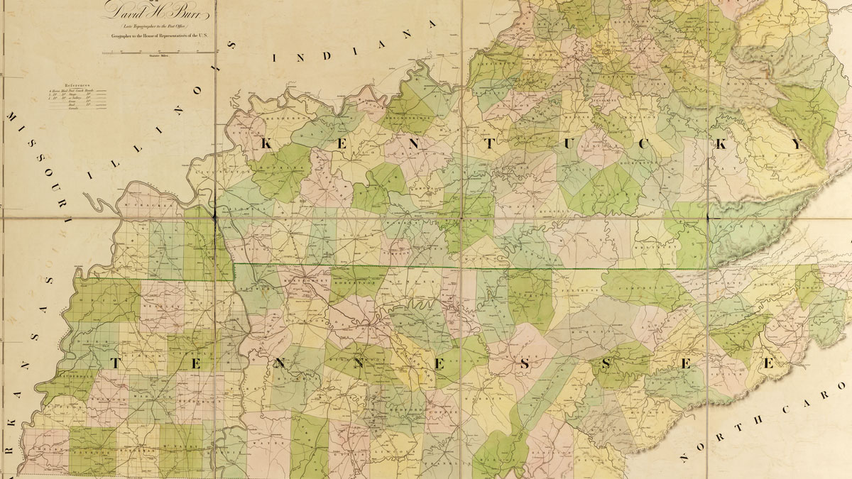

Look at a map of Tennessee and Kentucky, and the northern border is not the straight line it was supposed to be.
It was meant to follow 36 degrees 30 minutes north latitude, a colonial line later inherited by both states. Instead, a 1779-1780 survey drifted north. At the Tennessee River, the border still makes a sudden jog that you can see from a highway or from an official state map.
East of the river, Tennessee kept the crooked survey. West of it, the states agreed to use a line much closer to the true latitude. That 1820 compromise is why the map looks like someone bumped a ruler and then decided to ink the mistake.
If you want a place to picture it, start at Kentucky Lake, where the Tennessee River still forms the line between the two states, not far from Paris Landing in Stewart County, on the approach to West Tennessee.
The Line Was Supposed to Follow a Parallel
The parallel of 36 degrees 30 minutes north was set as the divide between Virginia and North Carolina. When those colonies’ western lands became Kentucky and Tennessee, the same latitude was supposed to separate them.
In 1779, Virginia named Dr. Thomas Walker and Daniel Smith to help extend that line west, where it had never been marked. North Carolina named Col. Richard Henderson and William Bailey Smith. Walker was already a figure in early Tennessee geography. In 1750, traveling for a land company, he had gone through Cave Gap, named it Cumberland Gap, and recorded his naming of the Cumberland River.
The two sides did not stay together. Henderson left the work. The Virginia commissioners kept going and ran what has been called Walker’s Line ever since, all the way to the Tennessee River.
They did not land on 36 degrees 30 minutes. Later writers have described the error as roughly 6 to 10 miles north of the true parallel along some stretches, and about 17 miles north by the time the party reached the Tennessee River. The usual explanation is a faulty allowance for the compass needle. Whatever the exact distance at each mile, the line sat north of where the charters said it should be, and both states noticed.
Why Tennessee Fought to Keep the Mistake
For Kentucky, the crooked line meant lost territory. In the early 1800s, the state pushed to move the border south to the true latitude. Tennessee, which had been governing and granting land up to Walker’s Line, wanted the survey left alone.
The fight dragged on for years. Tennessee offered to settle on Walker’s Line in 1803, 1815, and 1817. Kentucky refused to treat on that basis alone. In 1819, it sent surveyors named Alexander and Munsell to mark the true latitude west of the Tennessee River. If Kentucky had succeeded in applying that true line all the way across, later Tennessee accounts warned that Clarksville would have ended up in Kentucky.
Tennessee had a lot to lose east of the river, where Walker’s Line left a long strip on its side of the intended parallel. The state’s answer was to send two of its strongest lawyers, Felix Grundy and William L. Brown, to meet Kentucky’s John J. Crittenden and Robert Trimble.
The 1820 Deal That Left a Jog in the Map
On February 2, 1820, the four men signed an agreement at Frankfort. Kentucky approved it on February 11. The articles of the compact are still the legal backbone of the line.
East of the Tennessee River, the border would be “the line run by the Virginia commissioners, in the year seventeen hundred and seventy-nine, and seventeen hundred and eighty, commonly called Walker’s line.” West of the river, it would follow the Alexander and Munsell line to the Mississippi River below New Madrid. Between the two points where those lines meet the Tennessee River, the river itself would be the common boundary.
That is the jog. The line comes west on Walker’s survey, hits the river too far north, follows the river, and then heads west again on a truer latitude. The Tennessee Encyclopedia notes that the offset at the river is still official on maps of both states.
The compact had another twist. Kentucky received the right to grant vacant land east of the Tennessee River that sat north of 36 degrees 30 minutes, even though Walker’s Line, the actual state border, lay farther north. In plain terms, Kentucky could issue titles in a strip that is inside Tennessee’s boundary. Kentucky’s land office later recorded thousands of those “South of Walker’s Line” grants.
You can see the result on maps in the Tennessee State Library and Archives historical map collection. The northern border is not a clean rule from the mountains to the Mississippi. It changes character at the river, which also helps mark the approach to West Tennessee.
A Smaller Jog You Can See From I-65
The river offset is the big one, but it is not the only wrinkle. In Simpson County, Kentucky, the line dips in a triangle into Robertson and Sumner Counties in Tennessee. The Kentucky Historical Society ties that irregularity to the same 1780 survey party.
A later survey in 1858 and 1859, by Austin P. Cox and Benjamin Peebles, marked the line in that area and left a Sumner County landowner named Middleton with about 100 acres on the Tennessee side of a small rectangular notch inside the triangle. The point is not that the whole border was redrawn then. It is that even a “straight” line, once people had built homes along it, was hard to pull tight without moving someone’s state.
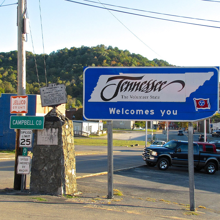
Drivers on I-65 and US 31-W cross near that triangle today. Kentucky Historical Marker 1850 stands at the state line on US 31-W.
Some of the later stone markers on Walker’s Line have had stranger fates. One, known as Stone 46, now sits underwater in Dale Hollow Lake at the Clay-Pickett county line, a reminder that reservoirs later covered a lot of Tennessee ground that used to be dry. That stone is a historical detail, not a stop to look for.
How to See the Border Today
You do not need a surveyor’s chain to understand the Walker Line. You need a map and, if you like, a couple of ordinary highway stops.
| Place | What to look for | Notes |
|---|---|---|
| Official state or historic maps | The jog at the Tennessee River, then a straighter run west toward the Mississippi and Reelfoot Lake | The TSLA map collection is a good starting point |
| Kentucky Lake / Tennessee River, near Paris Landing | The stretch where the river, not a straight parallel, is the state line | Public parks and lake access on the Tennessee side; the jog is the legal line, not a single required monument |
| US 31-W at the Kentucky-Tennessee line (I-65 is nearby) | Simpson County’s triangular dip into Tennessee; Marker 1850 | A roadside stop, not the same feature as the river jog |
If you’re already building a trip around unusual historic sites in Tennessee, the border itself is worth a look on the way north. The mistake is not a rumor, and it was not quietly erased. It is the line on the map.