
One storm. That’s all it would take.
Knoxville averages just 4.6 inches of snow a year, so a single 5-inch snowfall this January would beat an entire normal winter.
Up in the Smokies, Kuwohi averages 18 inches of snow in January alone. Gatlinburg, at the bottom of the same mountains, averages 2.3.
And NOAA now expects a wetter-than-usual winter across the South as a strong El Niño builds.
So will Knoxville finally get its snow day? It comes down to one thing: whether those storms show up when it’s cold enough.
And the answer depends on more than the national forecast.
Why NOAA Expects a Wetter Winter in East Tennessee
NOAA’s November 12 El Niño update confirmed that the weather pattern is strengthening, with a strong to very strong El Niño likely to continue into early 2027.
El Niño develops when ocean temperatures in the tropical Pacific become unusually warm. That warmth can change atmospheric circulation and shift the jet stream, influencing where storms travel across the country.
During strong El Niño winters, the southern United States often experiences a more active storm track.
In its October 15 winter outlook, NOAA identified increased chances of above-average precipitation across much of the South and along the East Coast.
For East Tennessee, that could mean more opportunities for winter storms between December 2026 and February 2027.
But NOAA isn’t predicting a certain number of storms, snowfall days, or inches of snow for Knoxville.
Its outlook describes which weather patterns are more likely over an entire season.
And a season with above-average precipitation can still be disappointing for snow lovers if the storms arrive during warmer periods.
Our read: NOAA’s forecast is a reason to pay closer attention to the storms heading toward East Tennessee this winter. It isn’t evidence that Knoxville is headed for an unusually snowy season.
For more background on how our state’s geography affects winter conditions, see our guide to what to know about Tennessee winter weather.
Knoxville’s 4.6 Inches of Snow Can Be Misleading
Here’s a number worth remembering: Knoxville averages just 4.6 inches of snow annually, according to the National Weather Service’s 1991–2020 climate normals.
That sounds like a relatively small amount, especially compared with northern cities that regularly experience heavy snowfall.
But the average doesn’t tell the whole story.
Imagine Knoxville receives five inches of snow from one storm this January.
That single event would already exceed the city’s 4.6-inch annual snowfall normal by 0.4 inches.
It wouldn’t mean the entire winter was exceptionally cold, and it wouldn’t require several weeks of snowy weather. One substantial storm could do it.
The reverse is possible, too. Knoxville could experience several days with snowflakes in the air but accumulate very little measurable snow.
That’s why snowfall totals, snowy days, and winter weather disruptions aren’t interchangeable.
There is also a timing difference worth understanding. The 4.6-inch normal represents annual snowfall, while NOAA’s winter outlook covers December through February.
A snowy March could contribute to the annual total without falling within NOAA’s three-month winter outlook.
So here’s the takeaway. An average snowfall figure helps explain local climate, but it isn’t a target or prediction for the upcoming winter.
The Same Storm Can Bring Rain to Knoxville and Heavy Snow to the Mountains
East Tennessee has a geographic complication that much of the country doesn’t experience to the same degree.
The Tennessee Valley sits between higher elevations, including the Cumberland Plateau to the west and the Appalachian Mountains to the east.
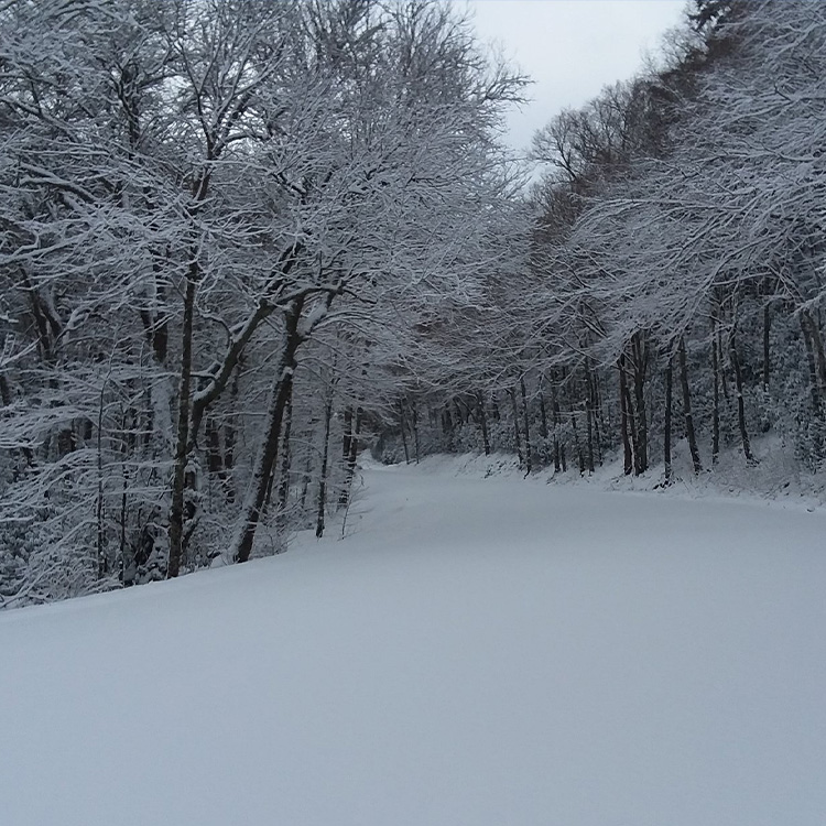
Local meteorologists sometimes describe a horseshoe-shaped snowfall pattern around the valley. Higher elevations can receive accumulating snow while lower communities experience rain or only a few flakes.
The National Park Service’s historical averages show just how large that difference can be.
| Location | Average January snowfall |
|---|---|
| Gatlinburg, lower elevation | 2.3 inches |
| Kuwohi, high elevation in the Smokies | 18 inches |
| Difference | Nearly 8 times as much at Kuwohi |
Source: National Park Service, Great Smoky Mountains weather averages. These are historical averages, not predictions for January 2027.
The Park Service also reports that temperatures can differ by 10 to 20 degrees between the base and top of the mountains.
That helps explain why a winter storm can produce such different outcomes over a relatively short distance.
And this isn’t just a hypothetical situation.
In its November 13 forecast discussion, the National Weather Service in Morristown expected 1 to 4 inches of snow at elevations of 3,000 feet and above in the Tennessee mountains, with locally higher totals possible. Some valley locations, meanwhile, might see flurries or a light snow shower.
The forecast illustrated exactly why elevation matters when winter weather arrives.
A family leaving Knoxville for the Smokies could encounter conditions quite different from those outside their front door.
And someone driving toward Crossville and the Cumberland Plateau shouldn’t assume that Knoxville’s forecast represents the entire journey.
For winter outings, our guide to Tennessee waterfalls to visit in winter also covers practical access and trail considerations that become important when temperatures drop.
What Would Actually Have to Happen for Knoxville to Get More Snow?
NOAA’s wetter outlook is only one part of the equation.
For Knoxville to experience substantial snowfall, three things generally need to come together: enough moisture, sufficiently cold air, and favorable timing.
El Niño may help influence the first ingredient by affecting storm tracks across the southern states.
The other two are much harder to predict months in advance.
A storm moving into East Tennessee during relatively mild weather could produce a soaking rain.
Move that same general weather setup into a period when sufficiently cold air is available, and the outcome could be very different.
Temperatures at different heights in the atmosphere also matter. Depending on how warm or cold those layers are, precipitation can reach the ground as rain, snow, sleet, or freezing rain.
A temperature close to 32 degrees at ground level does not, by itself, guarantee snow.
There is another complication: an entire winter can finish warmer than average despite experiencing several periods of unusually cold weather.
A single well-timed cold spell could produce Knoxville’s most memorable snowstorm of the season.
Conversely, frequent storms during mild conditions could leave the city with plenty of rain and very little snow.
The key question isn’t simply how many storms arrive. It’s how often those storms overlap with cold enough conditions to produce snow.
That’s the part of the 2026–27 outlook we won’t know until individual systems begin approaching the region.
How to Tell Whether an Approaching Storm Could Affect Your Plans
One of the most useful things East Tennessee residents can do is stop treating a regional winter forecast as though it applies equally to every community.
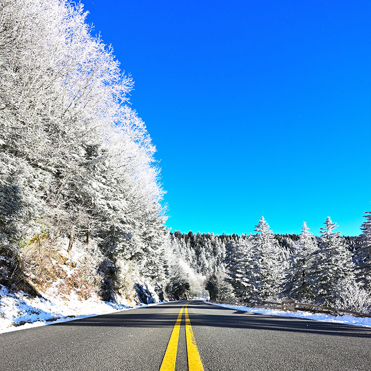
A Knoxville forecast might be perfectly reasonable for someone staying in the city, but less useful for a family driving across the Cumberland Plateau or heading into Great Smoky Mountains National Park.
When winter weather approaches, here’s what to check.
| Your plans | What to check | Why it matters |
|---|---|---|
| Staying around Knoxville | Local hourly forecast, precipitation type, and weather alerts | Rain, snow, and freezing precipitation can have different effects on the morning commute |
| Driving toward Crossville or the Plateau | Forecasts along the entire route, especially higher elevations | Conditions can change as the road climbs out of the Tennessee Valley |
| Visiting Gatlinburg or the Smokies | Destination and mountain forecasts, park road conditions, and winter alerts | Higher elevations may receive snow or experience road closures even when Knoxville has rain |
Start with the National Weather Service in Morristown, which provides forecasts and weather alerts for much of East Tennessee.
During winter events, its winter weather page is another resource for snowfall information and forecast products when available.
For highway travel, the Tennessee Department of Transportation provides SmartWay traffic and road information, including weather-related road conditions and traffic cameras.
And if the trip involves the Smokies, check the National Park Service’s current conditions page before leaving. Roads can close because of hazardous conditions even when the surrounding towns remain accessible.
There’s a practical distinction here that snowfall predictions alone don’t always answer.
Knowing that a mountain destination might receive snow is useful. Knowing whether the road leading there is open is what determines whether the trip can happen.
Could Knoxville Have a White Christmas in 2026?
It’s an understandable question whenever a wetter winter forecast appears.
But NOAA’s outlook doesn’t tell us whether Knoxville will have snow on December 25.
A wetter seasonal pattern increases the potential for precipitation over several months. It doesn’t identify which days will be wet or whether temperatures on those days will support snowfall.
A white Christmas requires snow on the ground on Christmas Day, regardless of when it fell.
Snow falling on Christmas Eve could create that result. So could a previous storm if the snow survives long enough.
Rain arriving on Christmas Day wouldn’t.
The National Weather Service’s climate records show that Knoxville has experienced significant Christmas snowfall before, including 7 inches measured on Christmas Day in 1969.
That historical example shows what’s possible, not what’s likely this December.
As Christmas approaches, individual forecasts will become far more useful than the seasonal outlook for making holiday plans.
And for anyone hoping to enjoy Tennessee’s winter scenery without depending on snowfall, our collection of 10 favorite winter activities in Tennessee, according to locals offers other ways to enjoy the season.
What We’re Watching as Winter Approaches
There are three developments worth watching as December gets closer.
First is whether the expected wetter pattern begins producing more frequent storm systems across the southern United States.
Second is whether those systems arrive during periods of cold air. A wetter pattern without favorable temperatures would do little to increase Knoxville’s snowfall.
Third is where the snow line develops when winter storms approach. That’s the difference between a rainy afternoon in the valley and accumulating snow in the mountains.
The November 13 forecast offered an early reminder of just how differently one weather system can affect East Tennessee.
NOAA’s outlook gives us a reason to watch for more winter precipitation, but it doesn’t settle the snowfall question.
Knoxville could finish the winter with more rain than usual, experience several meaningful snow events, or see a combination of both. The seasonal forecast doesn’t yet distinguish among those outcomes.
For residents, the best approach is to follow the changing local forecasts rather than make plans around a national seasonal prediction.
And when snow finally does appear in the forecast, pay attention to where it’s expected to fall.
In East Tennessee, the difference between an ordinary rainy day and a significant winter weather event can be the stretch of road between the valley and the mountains.